Star Party Map
 Click to Download
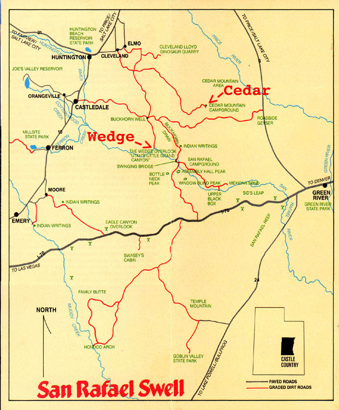
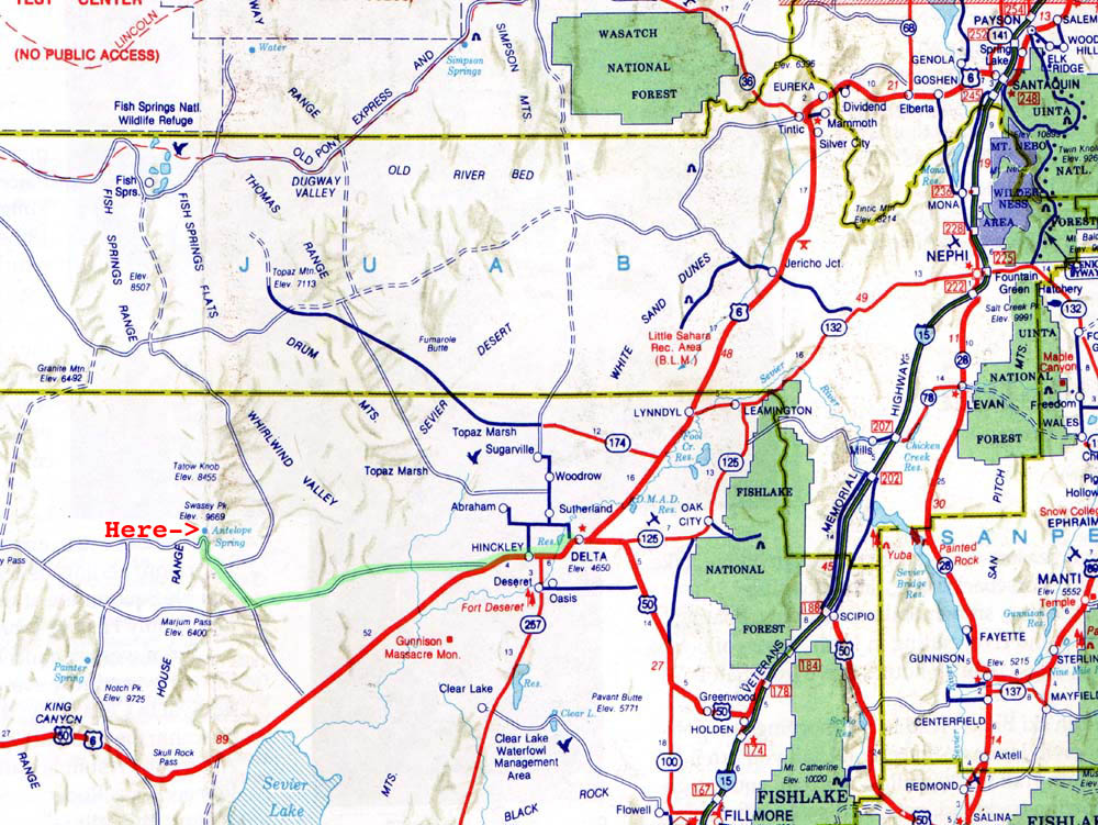
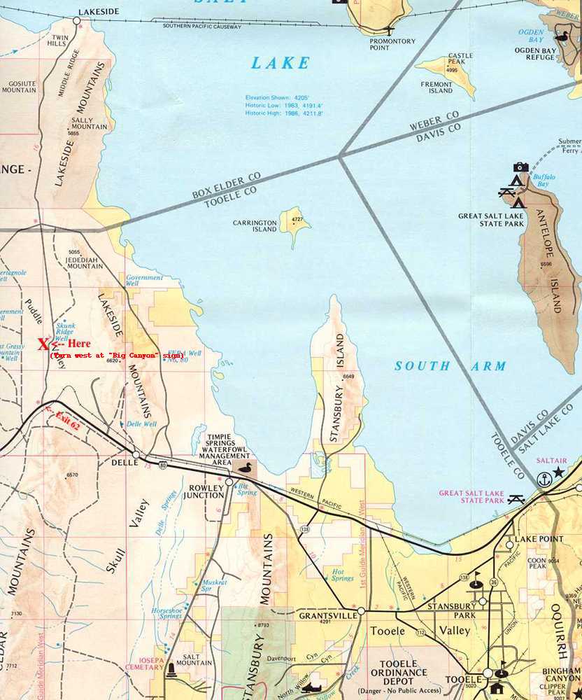
The Antelope Springs Site, located west of Delta.
Features: Very dark skies, low southern horizons. Fossil beds, rock hounding, hiking.
Distance from SL: ~160 miles
Access: Year-round, 25 miles of unpaved road.
Facilities: Water at springs.
Directions: From Delta, travel about 40 miles west to the north side turnoff for Sinbad and Death Canyon. Proceed north for 20 miles to the springs. Continue north to the left turnoff for Death Canyon, and proceed south for about 1/2 mile. Additional campsites are located north of the second turnoff, about 1/4 mile up the road.
 Click to Download
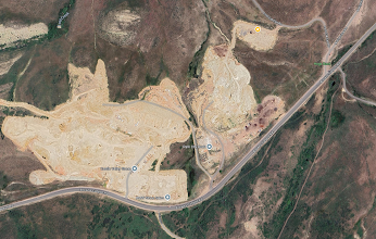
Gravel Pit Site Directions
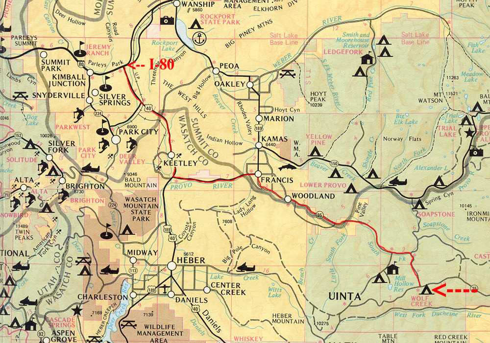
The Gravel Pit Site, located east of Park City.
Features: Dark skies to the south and east.
Distance from Salt Lake City: ~39 miles
Coordinates: 40°43'17.7"N 111°23'35.6"W
Access: Summertime, 1/4 mile of unpaved road.
Facilities: None
Directions: From Salt Lake City, take I-80 east up Parley's Canyon to Park City. Take exit 146, merge onto US-40 towards Heber City. Exit 4, go east toward Kamas. Turn left onto Browns Canyon Rd toward Peoa for 6.4 miles. Turn left onto N Highview Rd, then left onto Lost Creek Canyon Rd. Follow the road for about 1/4 mile to the parking area.
Google Location: Gravel Pit Site
 Click to Download
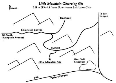
The Little Mountain site, located at the top of Emigration Canyon, SLC.
Distance from SL: ~10 miles
Access: Summer and autumn.
Facilities: None.
Directions: From Salt Lake City, go up Emigration Canyon for about 8 miles to the summit. There's a gate on the right; continue up the dirt road for about 0.1 miles to the top. Dim headlights when reaching the top.
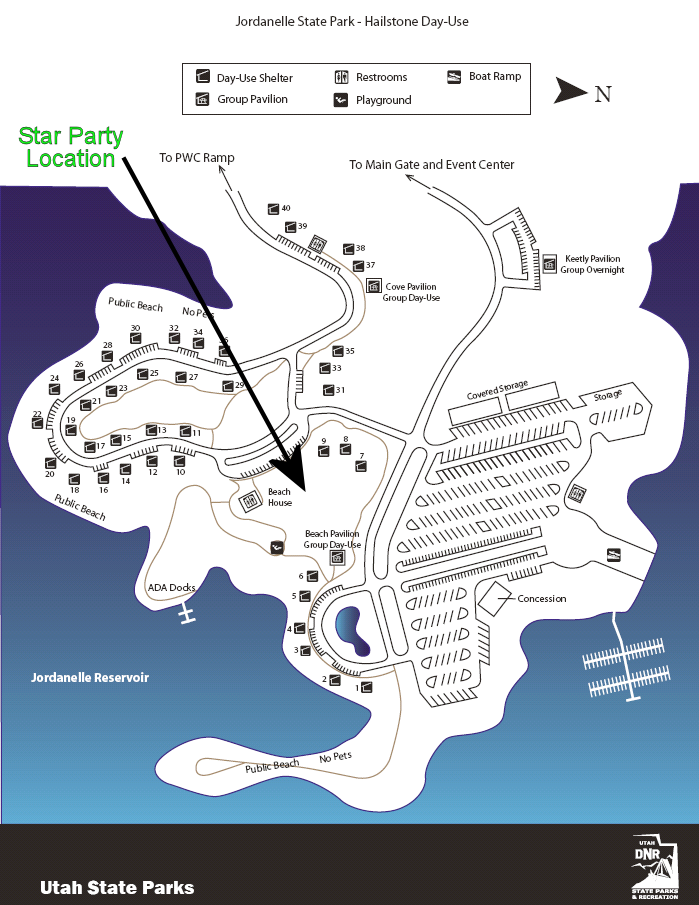
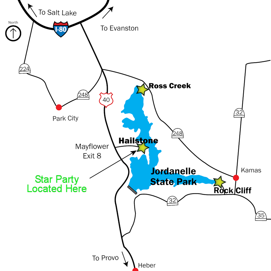
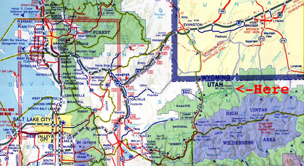
The Jordanelle State Park site, located east of Park City.
Features: Ample parking, dark skies.
Distance from SL: ~38 miles
Facilities: Restrooms.
Directions: From Salt Lake City, take I-80 up Parley's Canyon. Exit 146 and merge onto US-40 towards Heber. Take the Mayflower exit (8). From the main gate, follow the road to the Beach House area.
 Click to Download
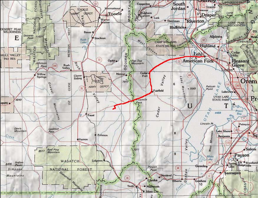
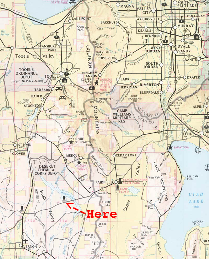
Pit 'n Pole Star Party Travel Directions
Pit 'n Pole is located at 40.207277 N, -112.267346 W.
From I-15, exit at Lehi and go west on State Road 73. Continue across the Jordan River, through the intersection of Redwood Road, and up past Eagle Mountain to Cedar Fort.
Follow the road to Fairfield, then 4.7 miles up the hill to 5-mile pass. Turn left onto a paved road and continue for 4.2-4.3 miles.
The road will curve slightly to the left before turning right. After the second rise, turn left onto a dirt road.
Continue south for 4/10ths of a mile and take the first dirt road on the right. Follow it 3/10ths of a mile to the site.
 Click to Download
 Click to Download
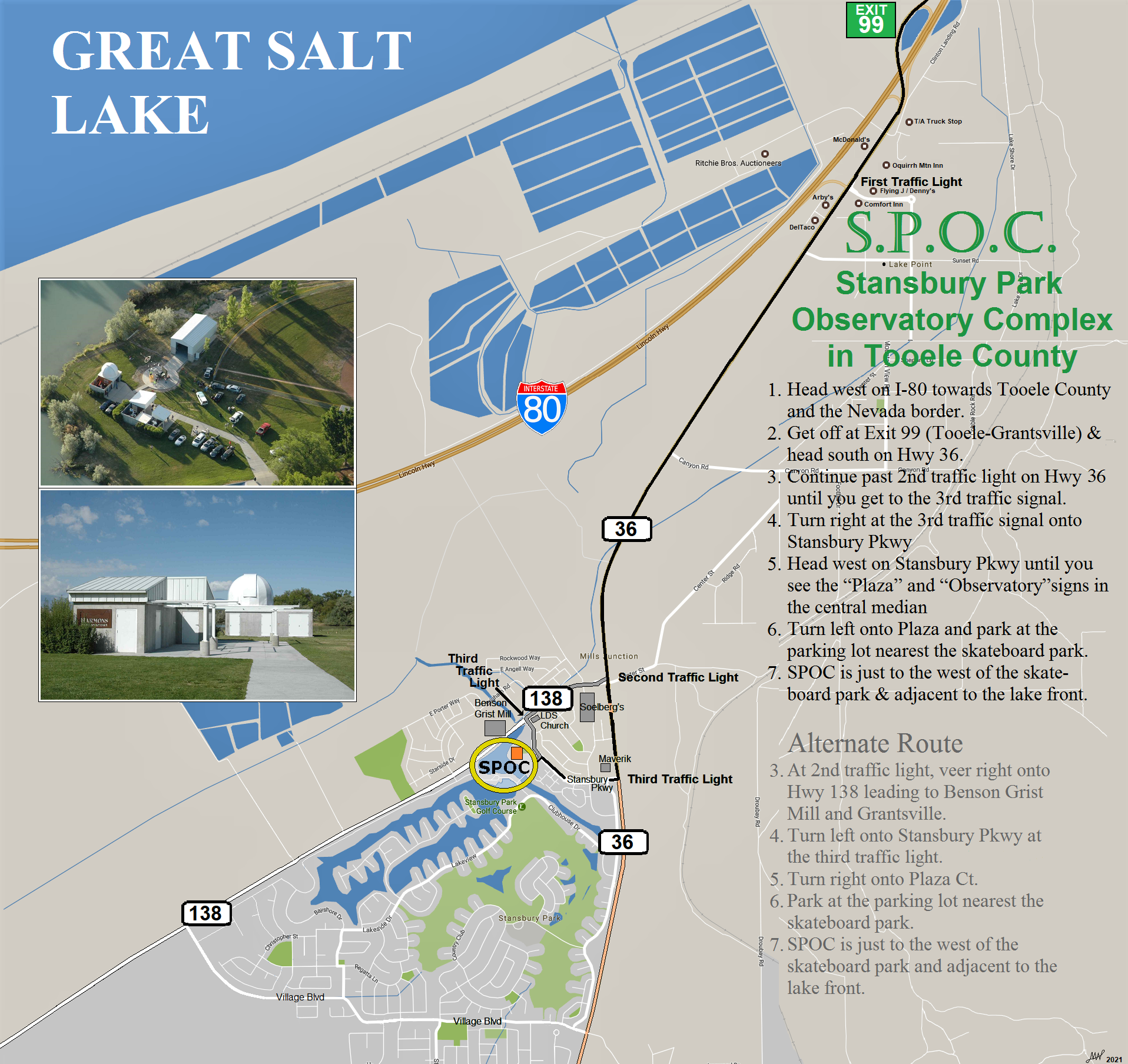
Stansbury Park Observatory, about 30 miles west of SLC
Distance from SL: ~30 miles
Access: Year-round.
Facilities: Restrooms near the ball field.
Directions: From Salt Lake City, take I-80 west. Exit at Tooele/Grantsville, continue south, and take the right fork to Grantsville. Turn right into Stansbury Park, then follow the first right to the parking lot.